In February, I was writing about how my students and I had been busily training for an impending trip to Sabah, East Malaysia (the west side of Borneo island) to climb Mt. Kinabalu. We departed during the March holidays for our 5-day-4-night trip, which included the climb as well as some sea kayaking. Mt Kinabalu is part of the Crocker range of mountains on Borneo. It is the highest mountain in SE Asia and the 20th highest in the world. Despite its height, however, it is a perfectly trek-able mountain, provided you are reasonably fit. Due to its proximity to the equator, Mt. Kinabalu enjoys relatively warm weather, even at the summit (rarely dips below 0 degrees celsius). Kinabalu Park itself is a World Heritage Site. The area is very important due to is unique and abundant fauna and flora, including the huge Rafflesia plant (biggest flower in the world, I believe) and the orangutan. Many of the species and endemic to the area.
On Day 1 we met up at Changi Airport to catch our 2+ hour flight to Kota Kinabalu (KK). From the airport at KK, it’s another 1.5-2 hour van ride to our lodging just outside of Kinabalu Park. There are many basic guesthouses located within a few minutes’ drive from the park headquarters. We stayed at Rose Cabin.


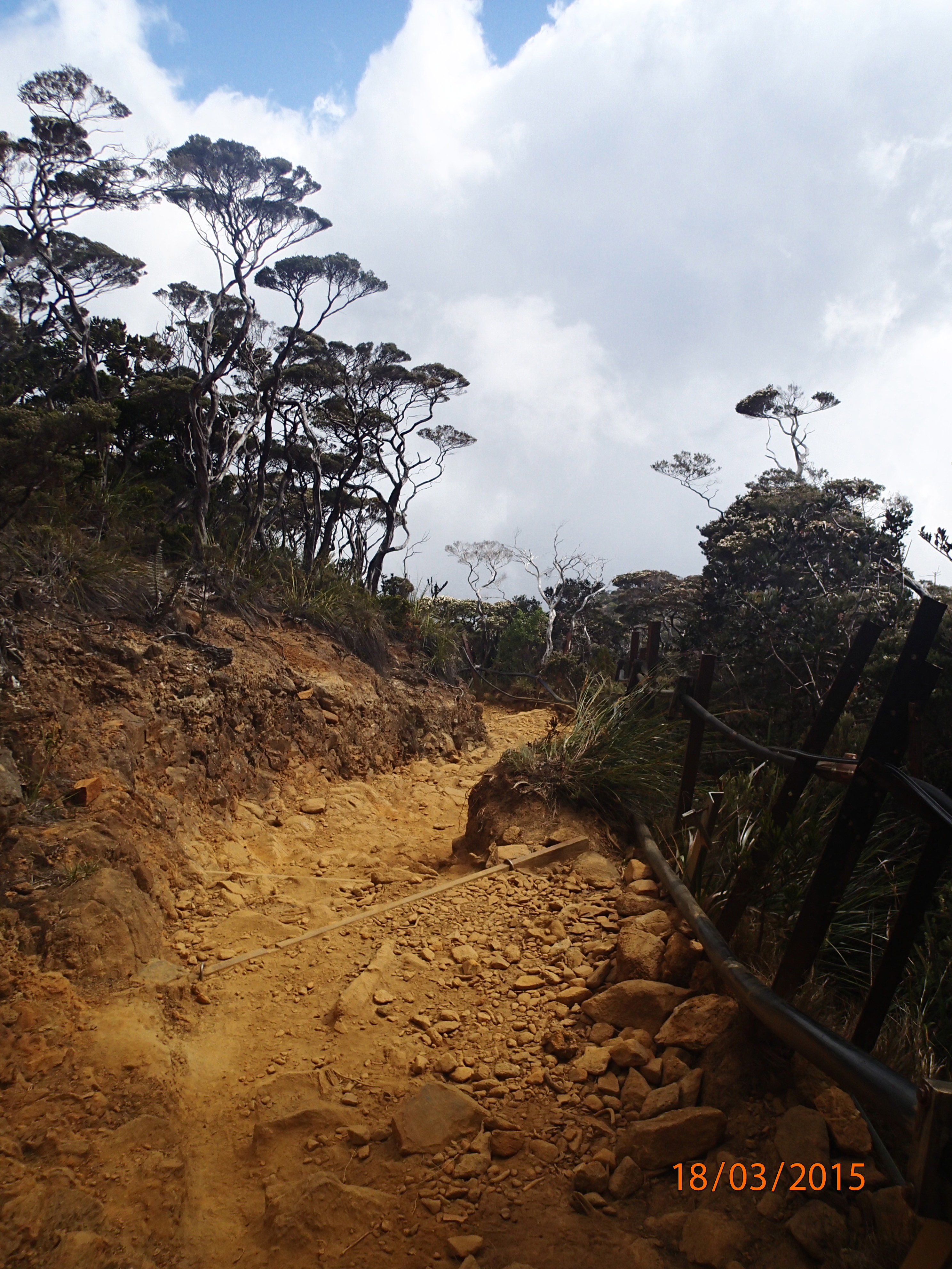
On Day 2, after overnighting at Rose Cabin, we checked into Kinabalu Park HQ and got our (mandatory) guides – Dolius, Yazik and Conrad. The guides are also necessary for confirming the altitude that you reach, required for when you receive your certificate after the climb. The climb up is fairly straight forward, actually. The trail is clearly marked and a series of huts provide toilet facilities and shelter at regular intervals.


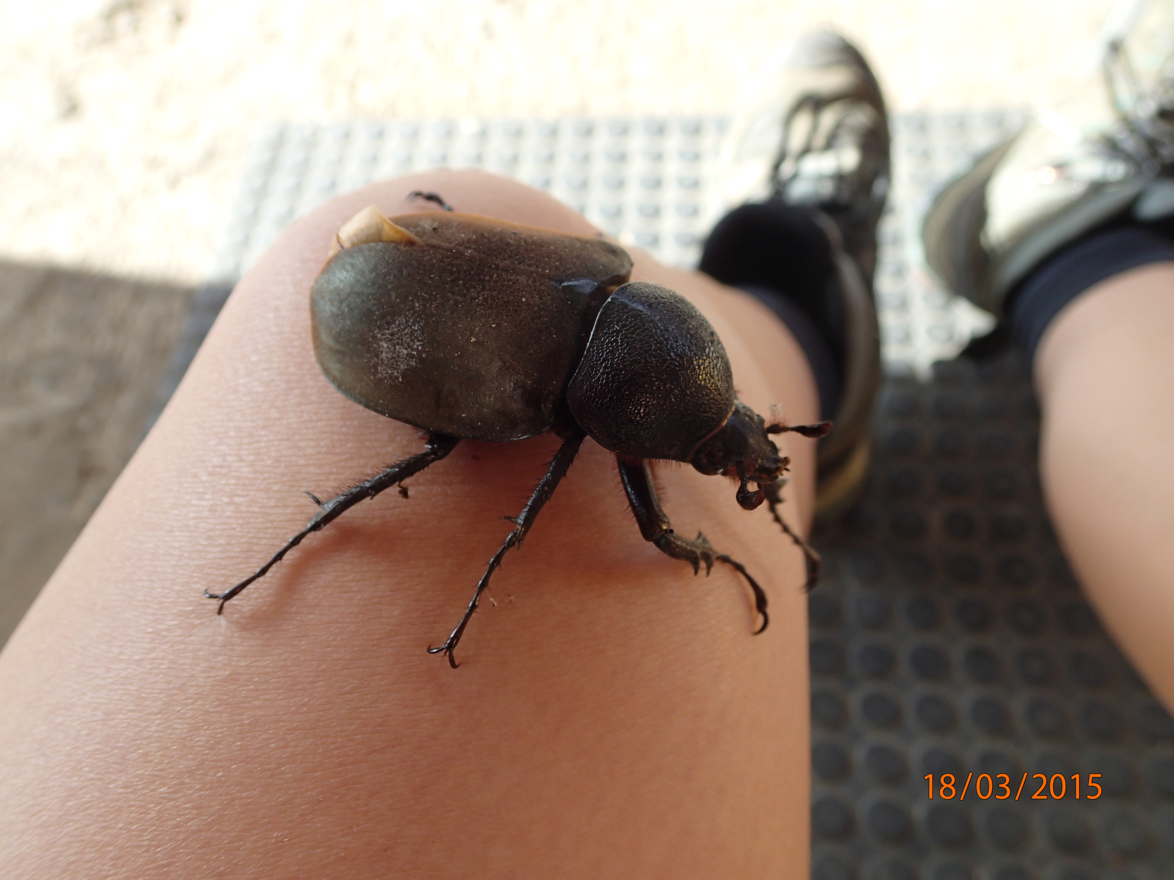
As we climbed higher, the dense jungle changed into more exposed alpine vegetation. We kept our eyes peeled for stick bugs, frogs and pitcher plants.


At around 1500m, some of our students were starting to feel the effects of altitude sickness. It is something that can’t really be avoided for those who a susceptible. So all we could do was to lighten their backpacks, rest often and be patient. Typical complaints we encountered were headaches, nausea and dizziness. Of course, for extreme cases of altitude sickness, immediate descent is necessary.
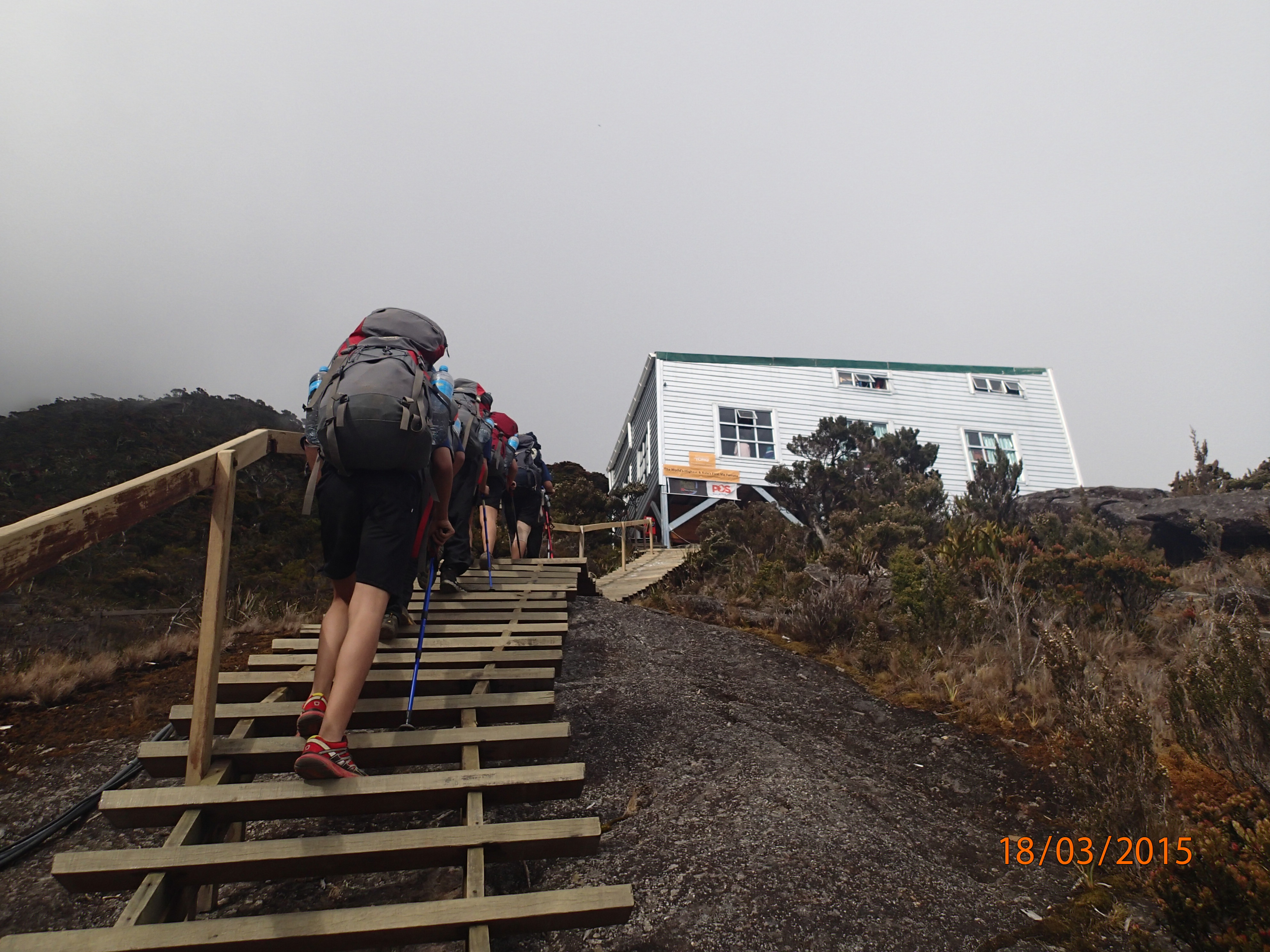
One particular student had a severe case of altitude sickness and vomited several times on the way up, unable to even keep water down. We reached our hut at around 4:30pm, after hiking for approximately 7 hours. Our group stayed at Pendant Hut, with dinner being provided in Laban Rata, the main building. There are several of these huts in the cluster, costing slightly different depending on the quality of facilities.
Dinner is a thing to behold on Mt. K. – a buffet-style meal can be had at Laban Rata. The selection is quite wide considering all the food had to be brought up by an army of porters. The local Sabah vegetables, lamb chops and soup are a personal favourite. Lots of carbs are available for fuelling up.

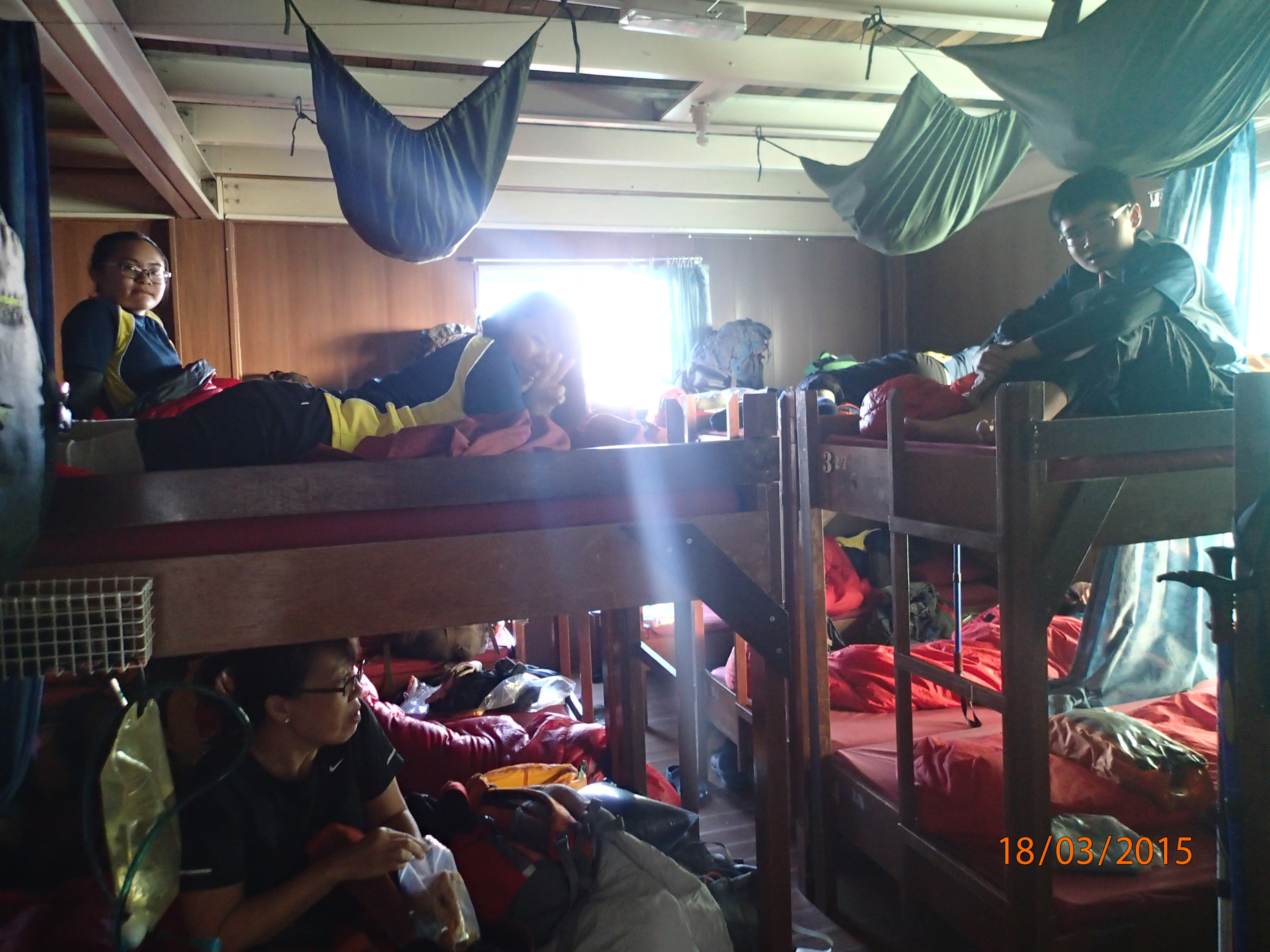
Usually people retire to their sleeping bags by about 7pm, hoping to catch as much sleep as they can before the 1:50am wake up call for breakfast. I ended up getting up at 1:30am because everyone else started waking up and creating noise (bring earplugs!). Luckily, a breakfast (supper?) of toast, peanut butter/jam and tea is served to fuel up for the summit push.
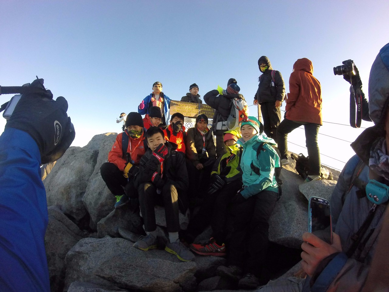
The summit trek started at around 2:30am, with a huge lineup of groggy people snaking their way up the mountain. The path is narrow and the going can be slow at first. Stairs. Suddenly we got past the tree line and things opened up – the unhindered view of the stars was amazing! A few shooting stars, too. Beyond the tree line, a white rope took to indicate the path. It can be steep in a few places, requiring the use of the rope to haul oneself up but mostly it’s just about going slowly and concentrating on putting one foot in front of the other. Soon we got to a plateau and you could see many of the other peaks, like St. John, King Edward, Ugly Sister, Donkey Ears etc. But we had to keep our eyes on the prize, which was Low’s Peak, the highest of them all. Not to mention you need rock climbing skills for the other ones. The final 200m to the summit is a bit tricky with many boulders and slightly steep. It’s an easy place to twist one’s ankle. The summit itself is small, with a simple sign that people can take pictures around. It’s a crowded place though, and people can become short with each other in order to get a nice summit picture. We got to the summit well after sunrise. The weather was excellent – not that windy, wet nor cold. We have gone in September in the past and rain prevented us from summiting.
Clothing wise, I managed to stay warm with a long baselayer, a tshirt, a light sweater and shell. For bottoms, I just wore normal hiking pants. A toque is nice but not necessary. Headlamps are a must. A light pair of gloves. A buff. You get the idea. However, my students, who weren’t used to the temperature, wore more layers.
Many say that the second day of the climb is worse and it’s true, you begin at 2:30 for the summit and then have to climb all the way back down to the starting gate. A second breakfast was served at Pendant Hut after the summit. Shortly after, we gathered our things and headed back down for a knee-bashing good time. We needed to be careful as most accidents happen on the way down of any mountain. After we finished, we went back to HQ, got our certificates and drove back to KK.

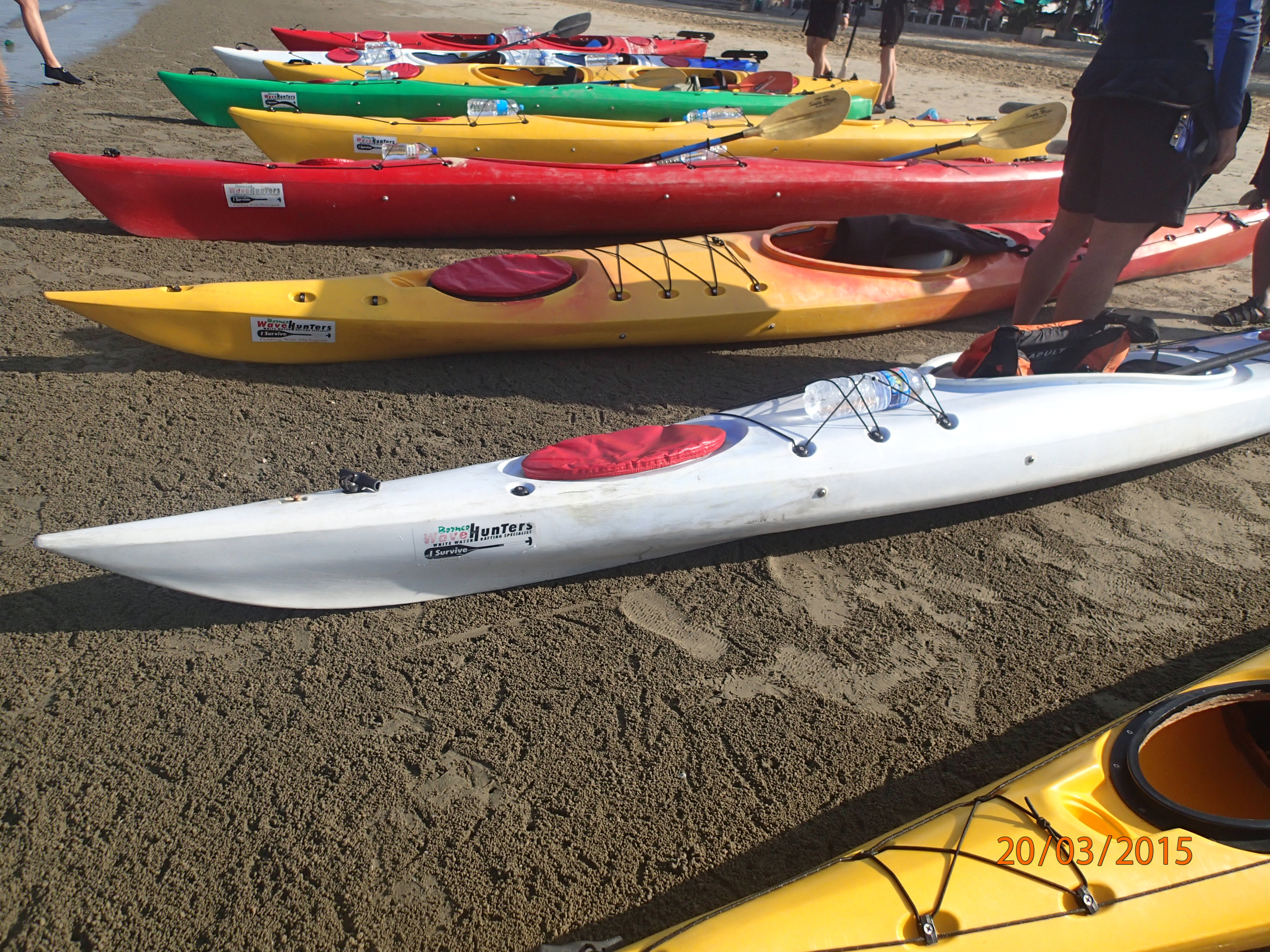
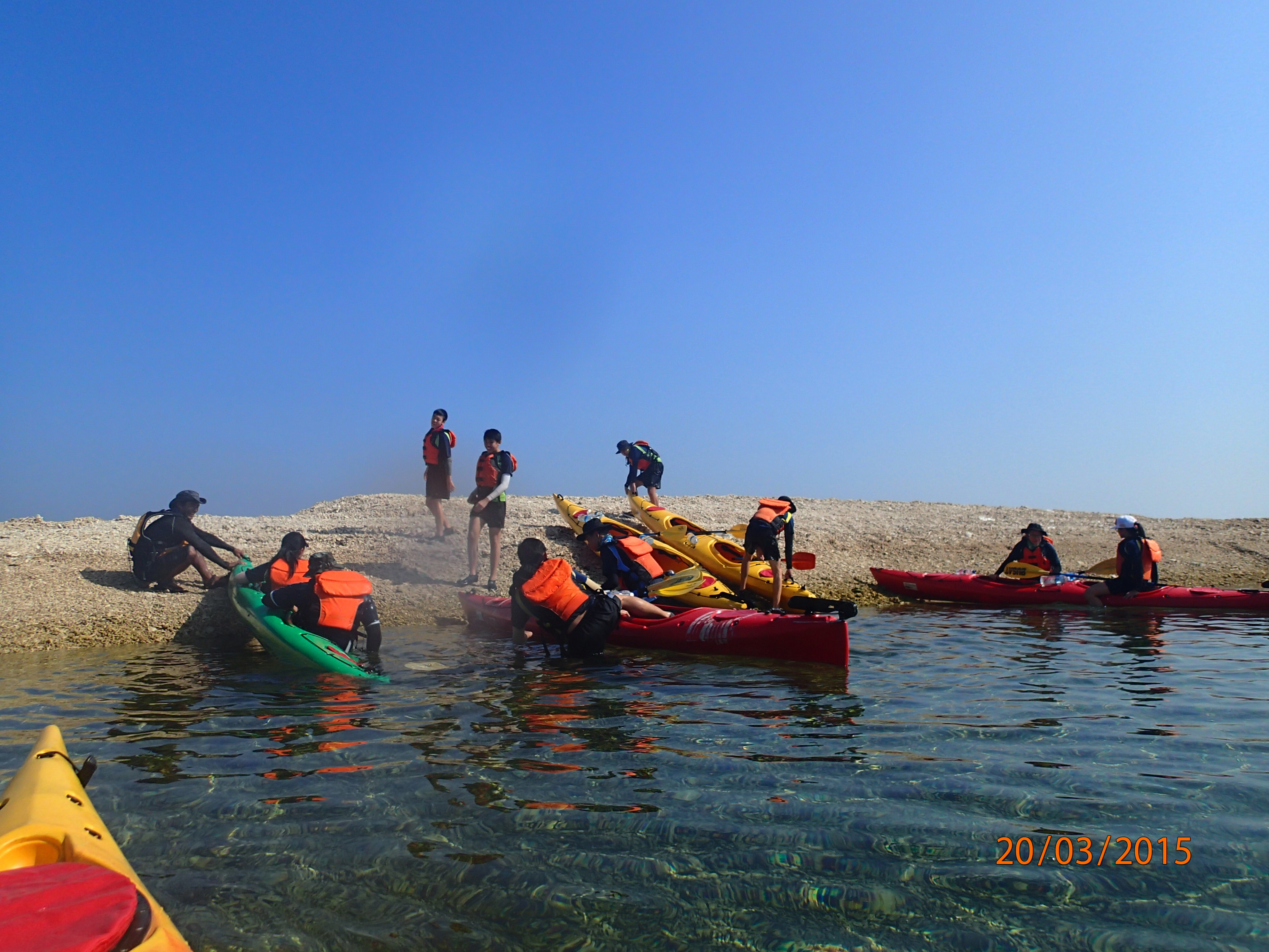
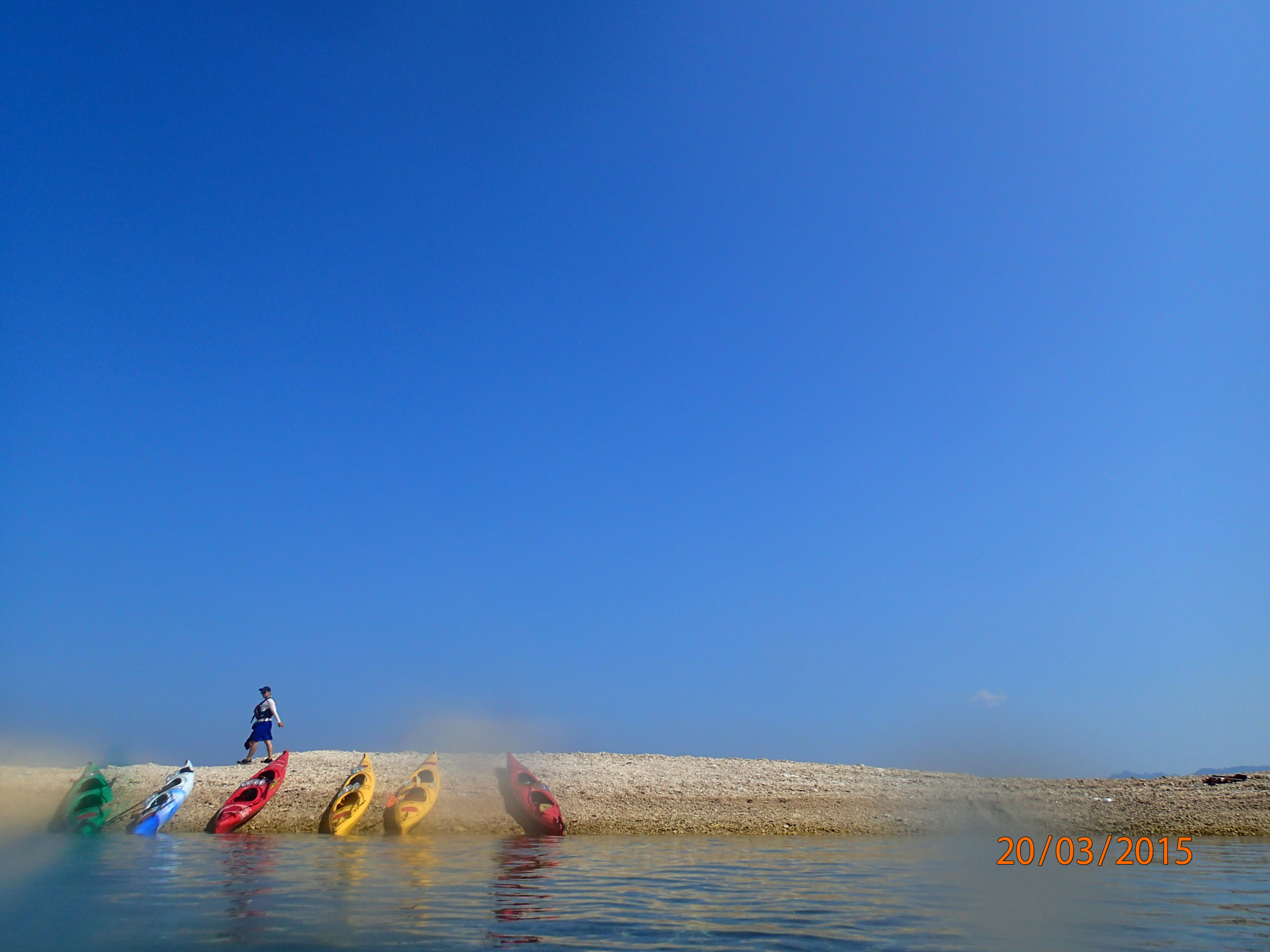
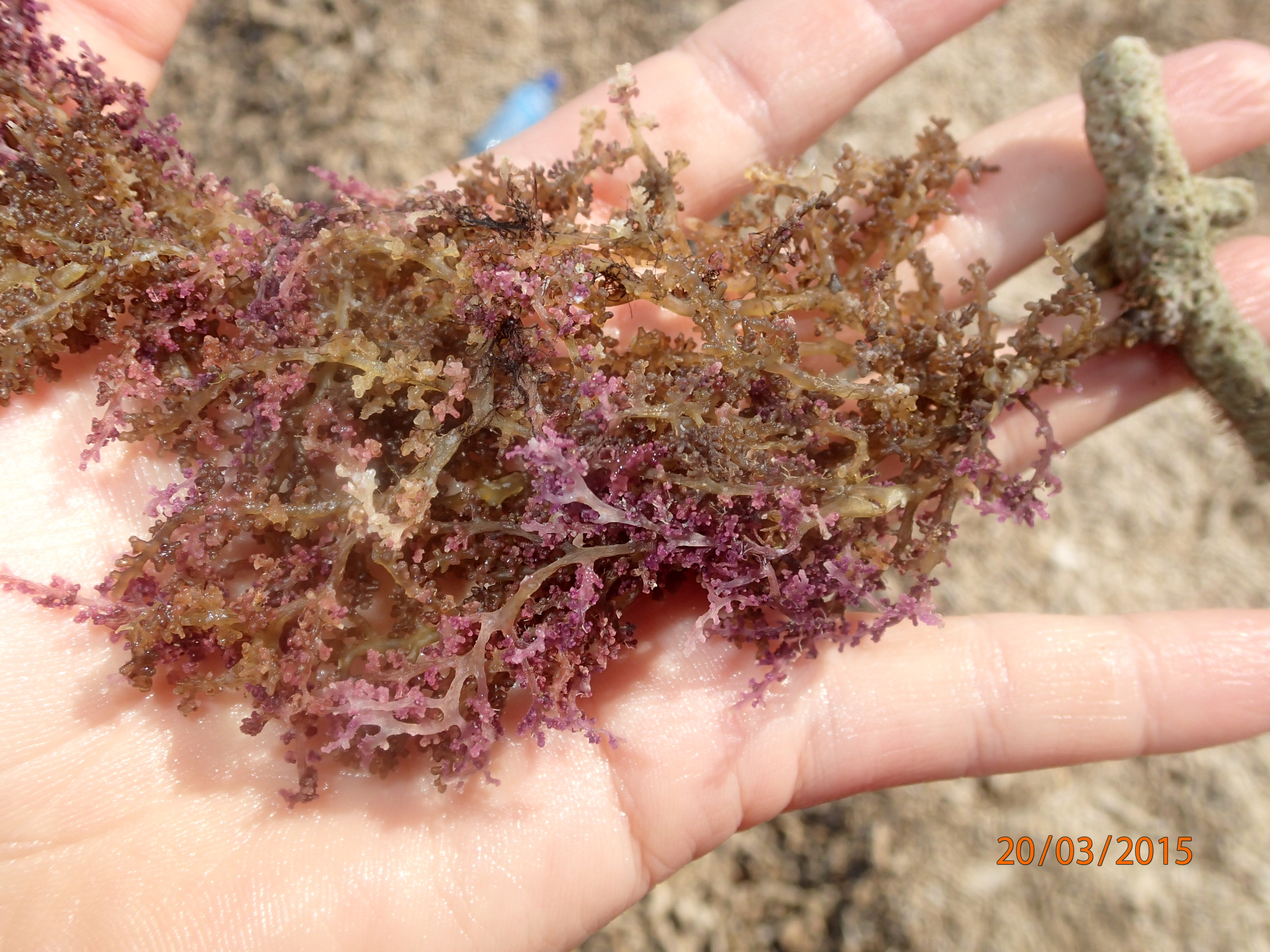
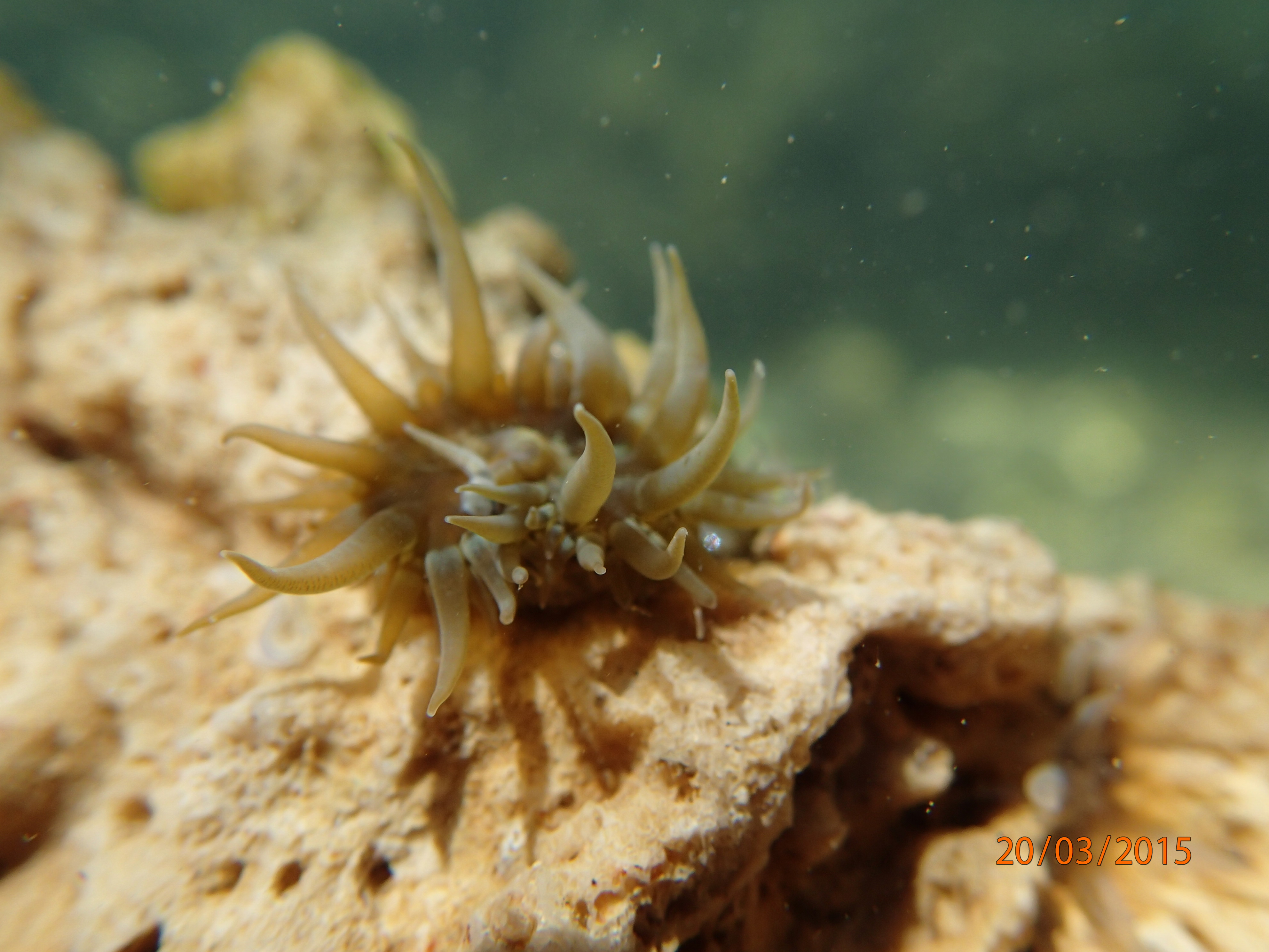
Day 4 brought relief to our sore legs in the form of sea kayaking. We met our guide from Borneo Wave Hunters at Tanjung Aru Beach on the outskirts of KK, who set us up with kayaks, paddles and PFDs. The really fascinating aspect about this paddle is that we get to visit an island comprised completely of broken pieces of coral that have been swept together by prevailing currents. Depending on the season, the island will actually ‘move’ due to changing currents.


The sea was especially calm on the morning of Day 4. Like glass. The drier season, with is calm weather, provided extremely clear green water as well. Our first stop was to the ‘Magic Coral Island’. We spent some time exploring the area via snorkelling and walking along the broken coral. After that, we circled Pulau Manukan and stopped on the island for a water break. Last stop was Pulau Mamutik for lunch before heading back to Tanjung Aru Beach.


Day 4 was our last activity day. The final day, Day 5 was spent in transport back to Singapore.
If you’re travelling to Borneo, I would suggest 2-3 weeks just for the Malaysian side (including Brunei) because of the amazing wildlife and abundance of activities to participate in. Just to name a few more things to do, you can trek through the rainforest in search of the very large (and smelly) Rafflesia flower, visit orangutans, check out some proboscis monkeys, go white water rafting, visit a cultural village, go diving and of course, just relaxing.
